
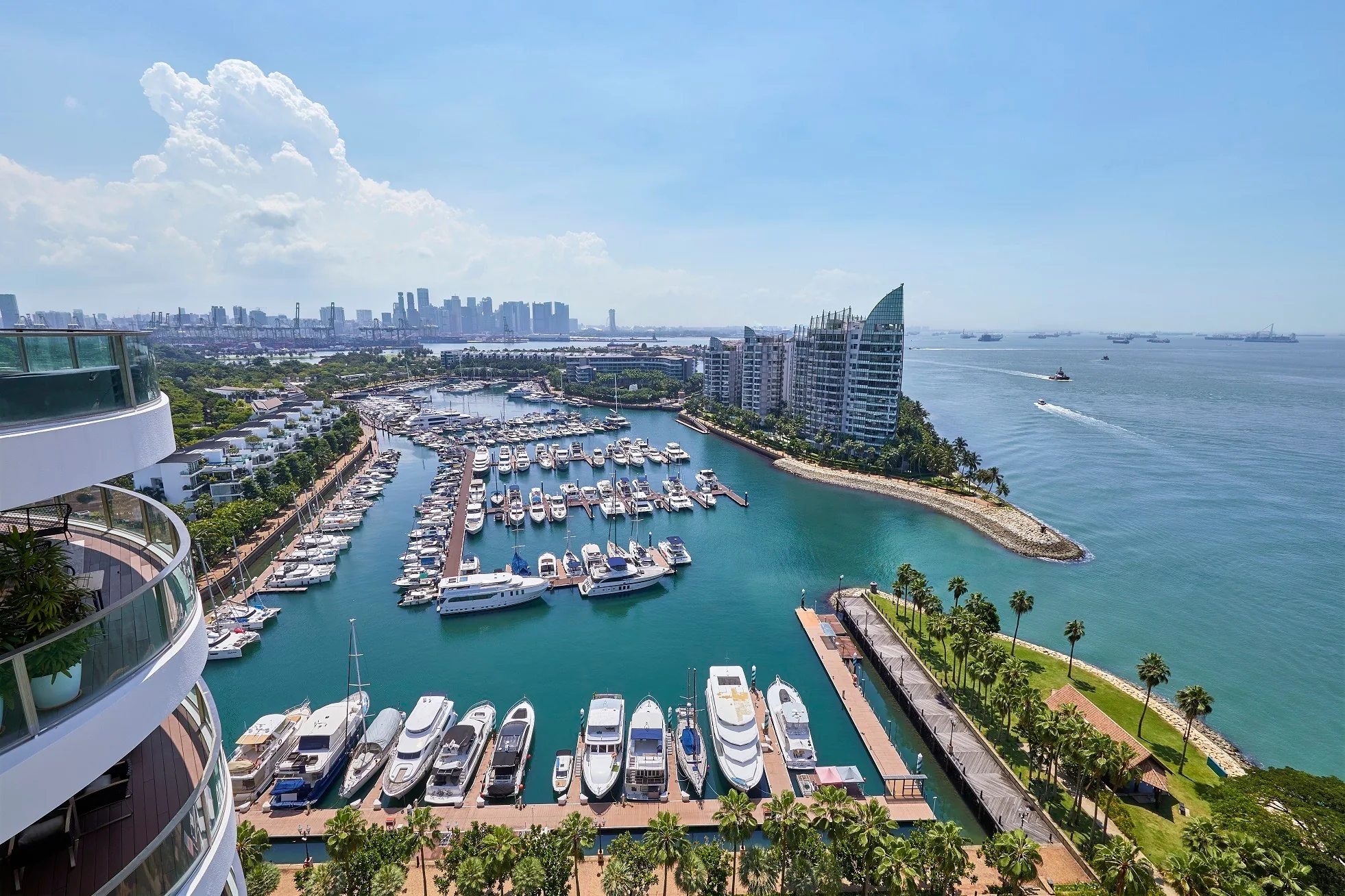
 Photograph
Cape Royale stands at 11 to 25 Cove Way on the seaward edge of Sentosa Cove, beside ONE°15 Marina, in District 4. HarbourFront MRT station is about 3.3 kilometres away in a straight line and about 4.8 kilometres by road.
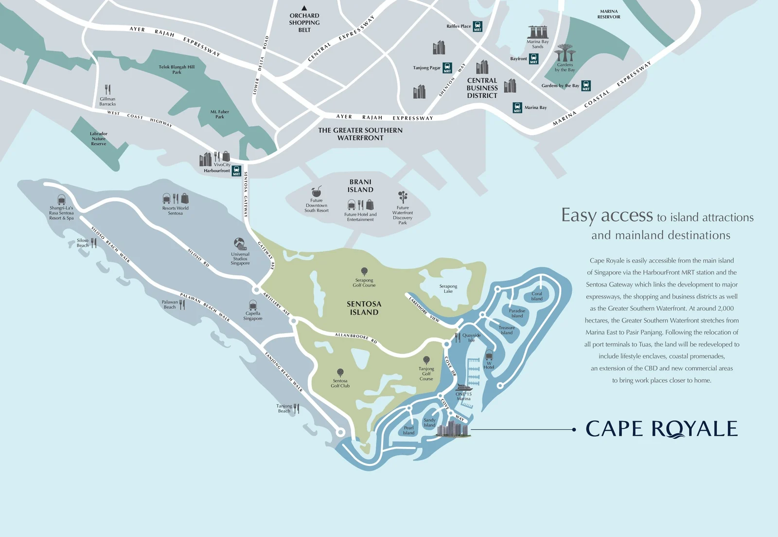
Cape Royale Location Map
Map centred on the site (1.24189, 103.83995). Open Cape Royale in Google Maps.
Cove Way runs along the outer rim of Sentosa Cove, between the marina basin of ONE°15 and the breakwater that faces the Singapore Strait. The eight towers of Cape Royale line it from number 11 to number 25, so the development forms the seaward edge of the whole cove, with the houses and canals of the enclave behind it.
The developer’s location map sets the address in a wider frame: the golf courses, beaches and resorts of Sentosa, the Sentosa Gateway and HarbourFront, and across the water the Greater Southern Waterfront, which the brochure describes as some 2,000 hectares from Marina East to Pasir Panjang, to be redeveloped once the port terminals move to Tuas.
Cape Royale Distances
The distances below are straight-line measurements from the site on OneMap; road routes are longer. They show what lies within reach of Cape Royale: the marina and restaurants of Sentosa Cove, the golf courses and beaches of the island, and, across the Sentosa Gateway, Keppel Bay, the rail network and the city.
On Sentosa
| Destination | Straight-line distance |
|---|---|
| ONE°15 Marina club, 11 Cove Drive | about 500 m |
| Quayside Isle, 31 Ocean Way | about 600 m |
| Sentosa Golf Club clubhouse | about 1.2 km |
| Tanjong Beach | about 1.2 km |
| Tanjong golf course | about 1.5 km |
| Serapong golf course | about 1.6 km |
| Capella Singapore | about 1.9 km |
| Palawan Beach | about 2.1 km |
| Universal Studios Singapore | about 2.5 km |
| Sentosa Boardwalk | about 2.6 km |
| Beach Station (Sentosa Express) | about 2.6 km |
Across the water
| Destination | Straight-line distance |
|---|---|
| VivoCity | about 3.2 km |
| HarbourFront MRT station (NE1 / CC29) | about 3.3 km |
| Keppel Bay Tower | about 3.5 km |
| Tanjong Pagar MRT station (EW15) | about 3.9 km |
| Marina at Keppel Bay | about 3.9 km |
| Mount Faber | about 4.0 km |
| Singapore General Hospital | about 4.2 km |
| Telok Blangah MRT station (CC28) | about 4.6 km |
| Henderson Waves | about 4.7 km |
| Raffles Place MRT station | about 4.9 km |
Measured on OneMap (SLA) from the site, 27 October 2026. By road, HarbourFront MRT station is about 4.8 kilometres away and Raffles Place about 8.5 to 9.3 kilometres, by Google Maps on the same day. The developer’s brochure gives ONE°15 Marina a seven-minute walk, Quayside Isle a thirteen-minute walk, and Sentosa Golf Club and Tanjong Beach six and seven minutes by car.
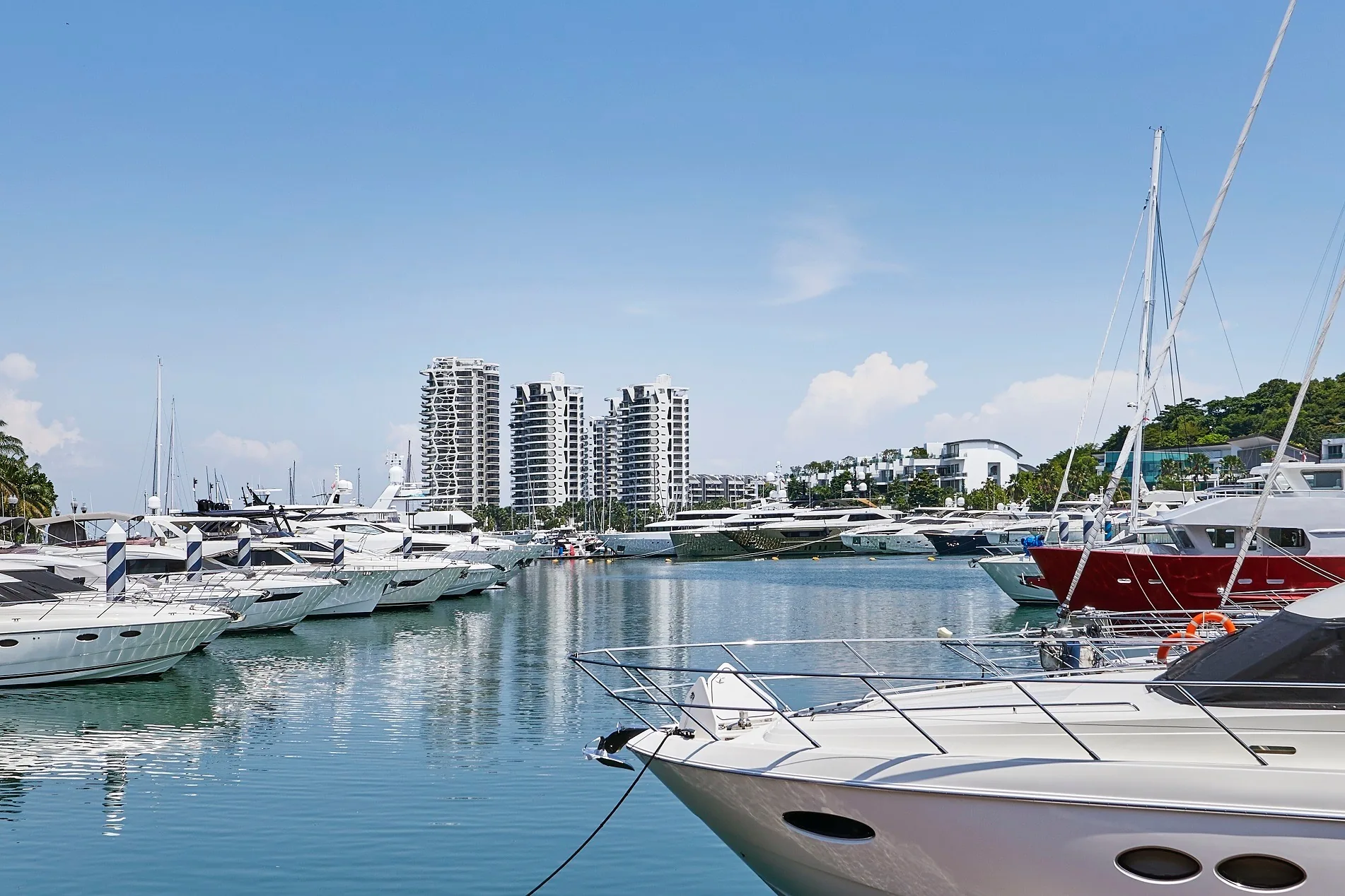
The neighbourhood around Cape Royale
Sentosa Cove is a waterfront residential district of houses on canals and islands, low condominiums and a marina, with its own restaurants and conveniences. From Cape Royale, ONE°15 Marina is the nearest neighbour and Quayside Isle the nearest place to dine, and the developer’s brochure points to groceries at Sentosa Arrival Plaza, about ten minutes on foot.
Five area guides look further: Cove Way and the sea, the Greater Southern Waterfront and Keppel Bay, driving and getting in, golf living and international schools.
Request the Cape Royale Price List
Cape Royale is completed and open for sale. The Sales Concierge sends the current price list and the homes still open for selection in Blocks 15, 17, 19 and 25. Showflat viewings are arranged by appointment through the Sales Concierge.
Sent on request
- The current price list and the homes still open for selection.
- The e-brochure and the floor plans you shortlist.
- The stamp duty for your profile and a loan estimate from the TDSR calculator.
- A viewing appointment at a time that suits you.
Request the Price List
No obligation. The Sales Concierge responds personally to every enquiry.
Prefer to speak to someone? Call +65 6200 6220, or send a WhatsApp message to the same number.